UPDATE: Thursday, January 30th, 2014
Phase II of the Integration of Aviation AWOS with RWIS project is in full swing. Tasks for this phase of the project include conducting a technical requirements analysis and developing an accompanying report, documenting additional sources of aviation weather information, and converting the high-level user needs and requirements into detailed, low-level system requirements. Server requirements and estimates for maintenance, along with plans for long-term maintenance and management of the system will all be examined.
Building on the prototype system developed in Phase I, the project team will expand data sources; improve usability, effectiveness, reliability and scalability; and enhance the prototype system with more unique and useful functionality. The Phase II prototype system will be fully functional and will support a greater number of simultaneous users.
The Phase II prototype already has some additional features and layers beyond the original Phase I system. A new look and feel has been developed to give a more intuitive interface and to be consistent with other WeatherShare products.
Main screen of the Aviation WeatherShare website:
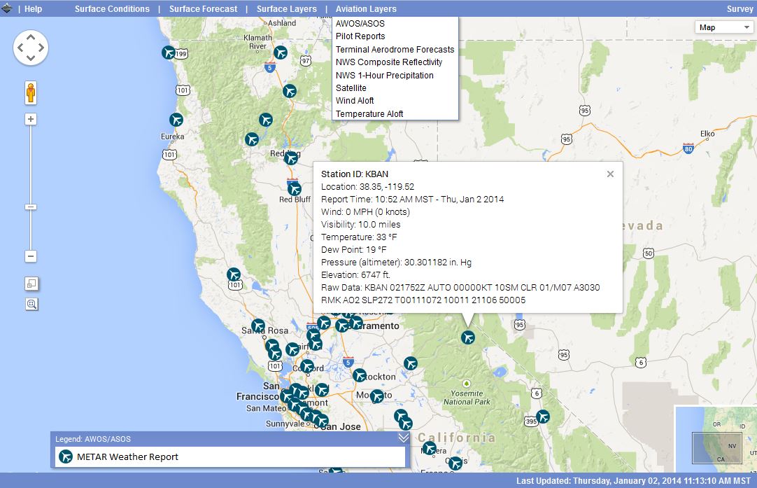
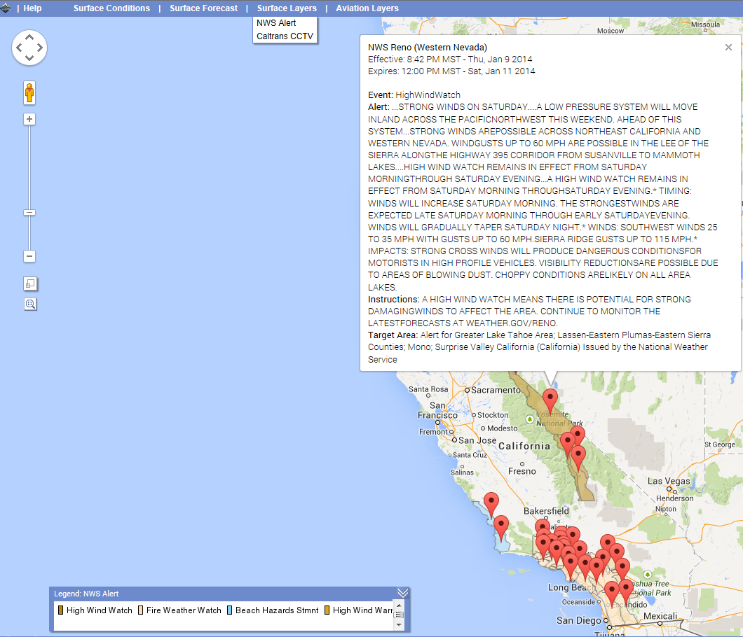
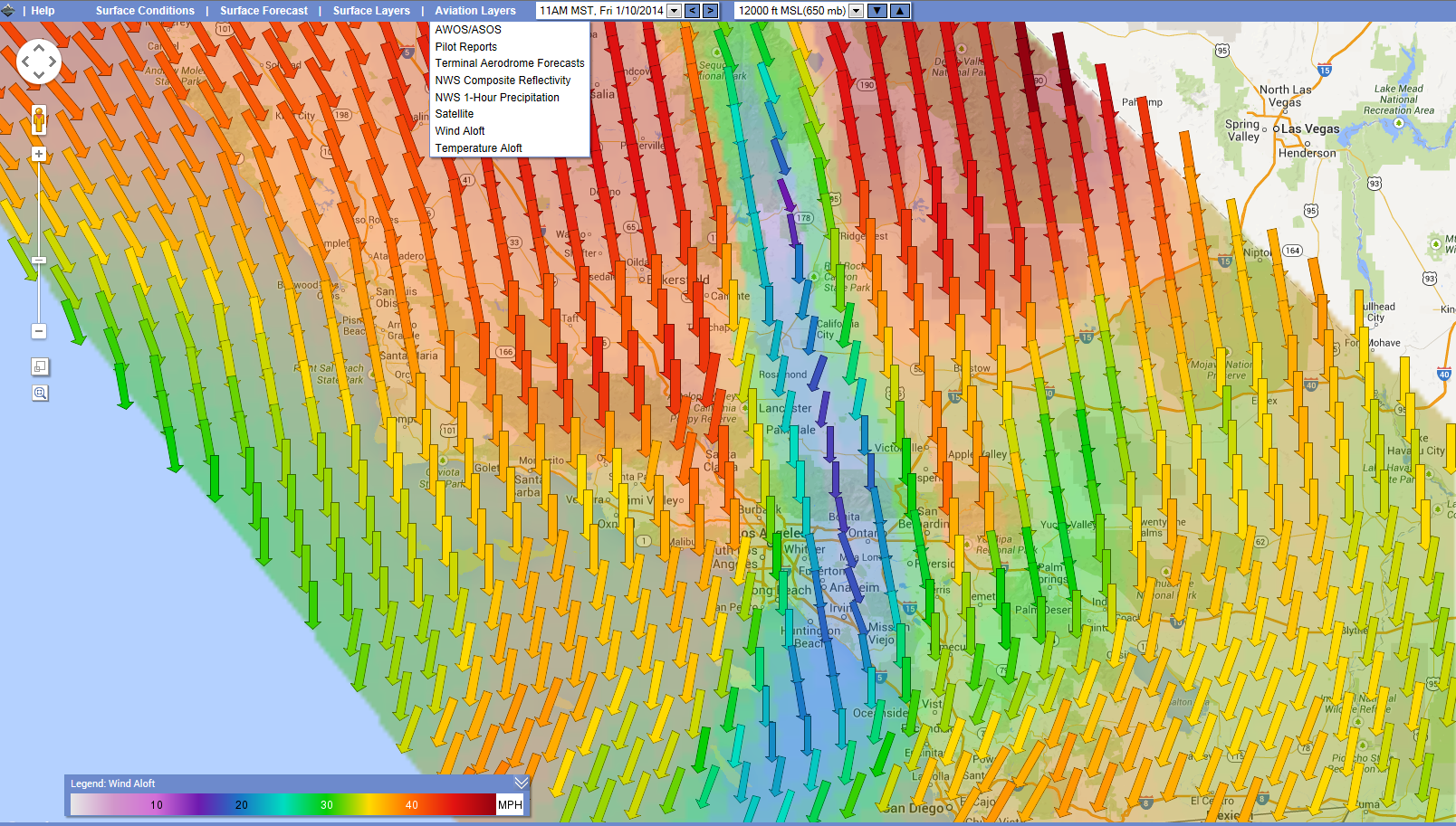
A larger map area, an increase in data types and accuracy, and an easier to use web interface have enhanced the system. With a larger map, users can view more data points on their screen. This is beneficial, for example, when observing and understanding weather patterns over a larger region and seeing how different data layers relate to each other, as shown below.
A NWS Alert for a High Wind Watch in Central California:
A pattern of strong Wind Aloft speeds in Southern California at 12000 ft:
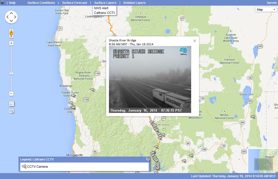
Being able to see what the current ground conditions are in near real-time can be a valuable asset for pilots in determining their flight path. For example, the weather conditions shown below could be very critical information for an EMS helicopter pilot preparing to make a safe flight and landing for a rescue operation.
Screenshot of heavy fog conditions captured on a CCTV camera near the Weed, CA Airport:
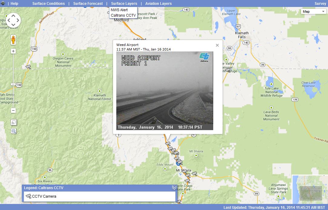
Screenshot of heavy fog conditions captured on a CCTV camera in Northern California:
The enhanced prototype system will be installed at a host site and training on how to use the system will be conducted. Documentation for operation, system administration and maintenance, and training materials will be created. One of the tasks in this phase will be comprehensive testing and evaluation over at least an entire winter season in order to evaluate system performance during severe weather conditions. The project team will conduct surveys, follow-up interviews and meetings with end users to gather feedback on the system.
The project team will also conduct a gap analysis between current AWOS/ASOS and RWIS stations in anticipation that a shared cost and benefit for both surface transportation and aviation communities can be achieved if a cooperative maintenance and deployment agreement can be reached. Finally, the project team will investigate needs and assess the viability of achieving FAA certified status for the system.
To see some of the features of the site view our Quick Start
Guide, watch our short Basic Usage Video or visit the Tutorial page
for more info:
Quick Start Guide: http://aviation.weathershare.org/QSG.htm
Basic Usage video: http://aviation.weathershare.org/video_basicusage.php/
Please give the website a try: http://aviation.weathershare.org/. If you have a few moments, we are collecting feedback on the site and appreciate any comments you may have. (Click on the Help menu and choose ‘Provide Feedback (Survey)’.)

