Integrated Corridor Management (ICM)
OVERVIEW |
LINK |
HISTORY |
FACT SHEET |
PROJECT AREA |
RESULTS |
CONTACTS |
UPDATE |
ARCHIVED UPDATES |
TUTORIAL
|
Integrated Corridor Management (ICM) seeks to coordinate individual network operations between parallel facilities/routes to create an interconnected system allowing cross network travel management. It is one of nine Tier I initiatives of the U.S. Department of Transportation’s Intelligent Transportation Systems program. The primary intent of ICM is to address the congestion issues that plague many urban areas. Traditionally, improvement efforts have focused on individual system components (freeways, arterials, transit), rather than an integrated approach. However, these individual system components often serve routes that are parallel to one another, forming a corridor linking the same origins and destinations. This presents the opportunity for operating and optimizing the entire system, which is the goal of ICM. The resulting improvement in traveler movement reduces travel times while increasing the reliability and predictability of travel. |
 Click here to visit ICM. |
UPDATE: Thursday, May 6th, 2010
One of our projects that doesn't get a lot of attention is Integrated Corridor Management (ICM). ICM was developed for DOT personnel in California and Oregon so they could better recognize conditions on both sides of the California-Oregon border. ICM is very similar to One Stop Shop, where you'll find most of the same information and more. Let's take a look at ICM.
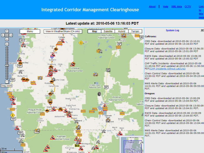
The first screen you see when opening ICM shows icons along the roads on both sides of the border.
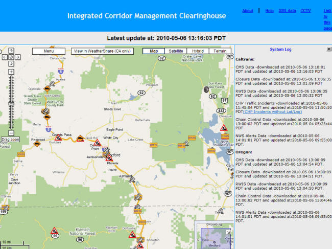
You can zoom in for further detail. Here we take a closer look at I-5 near the border.
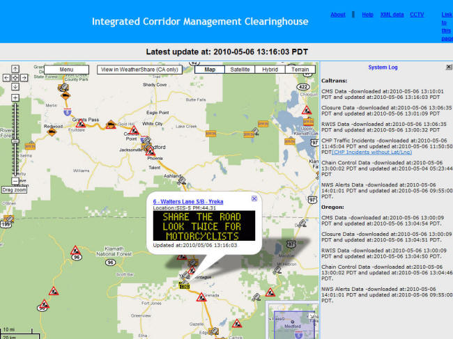
Click on an icon to see further detail. Here, a CMS message is shown. Note that the CMS icon is colored yellow to indicate an active message. The icon will be grey if there are no messages.
This icon reveals construction information:
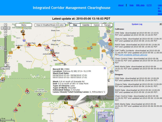
RWIS (Road Weather Information Systems) icons present weather sensor information. It looks like the conditions are pretty good today along the Pass:
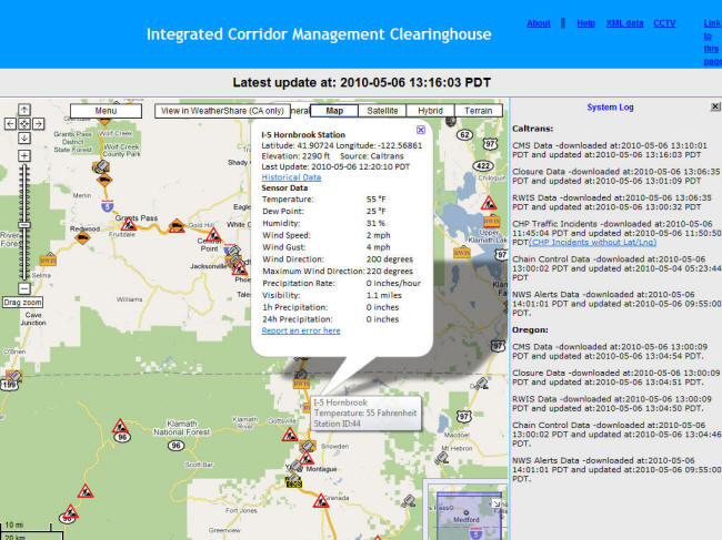
Camera images are available too, and this one confirms that it's a beautiful day along I-5 near Yreka:
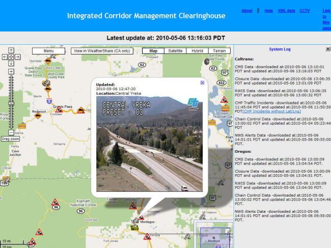
The road looks good as you go up the pass towards the border:
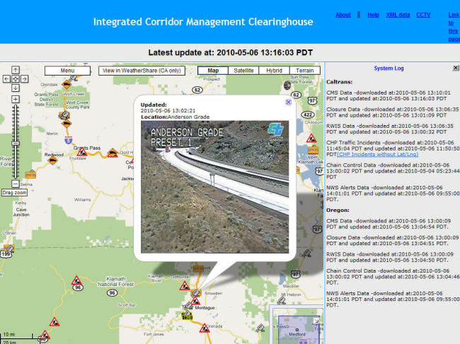
And, Siskiyou Summit is clear too. There have been a few snow storms over the past several weeks in the area, so it never hurts to check conditions:
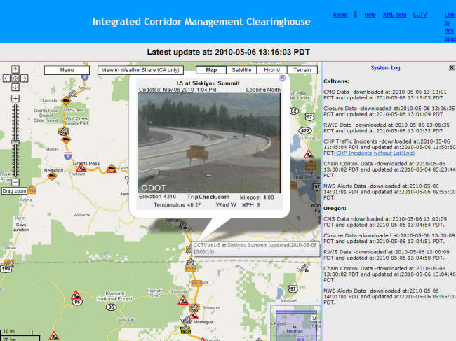
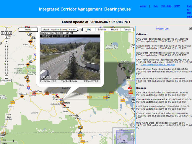
It's a beautiful day in Medford, too:
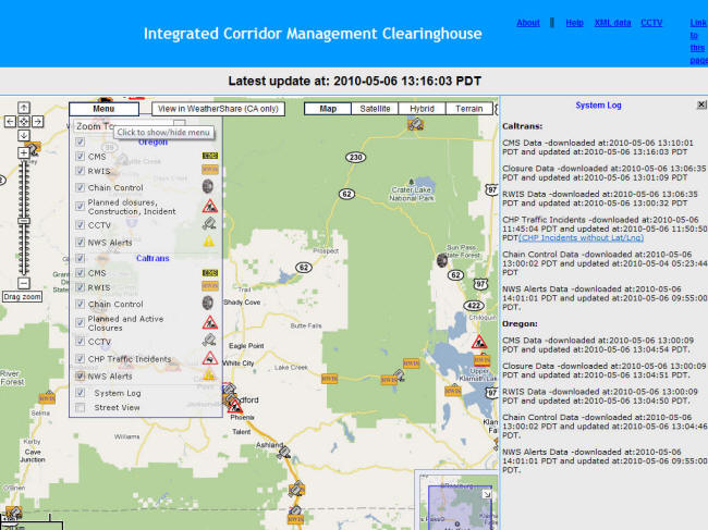
The screen might get overwhelming with all icons displayed. You can select which ones to view using the menu:
Incident/accident data from CHP is available too. Here we see a number of incidents further south:
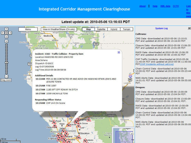
The type and severity can sometimes be determined from the detail:
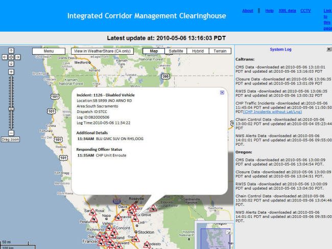
This one seems fairly harmless, although it was reported by CHP:
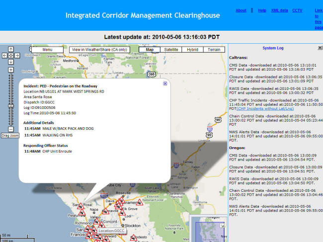
Check back soon for more ICM updates.
The study area was within Caltrans Districts 1 and 2, as well as ODOT Regions 2, 3 and 4. In examining maps of this region for potential candidate corridors, it was evident that I-5, as well as the US 97/OR 58 routes between Weed, California, and Eugene, Oregon, were roughly parallel. These parallel routes made them ideal candidates for rural ICM. In addition, both of these routes hosted to a number of ITS deployments, including traffic cameras, VMS and Road Weather Information Systems (RWIS). The availability of these deployments both assists in data collection for decision making processes (e.g., during weather events) helps in relaying information to travelers en-route.
The primary benefit of rural ICM in this study area stems from the tendency for weather to close or restrict (chain requirements) travel along a given route. Numerous mountain passes exist in the study area, including:
| I-5 Passes | Additional Passes |
|---|---|
|
|
While weather conditions on one or more of these routes/passes may be restrictive to travel, weather along the alternative route(s) may not be, in part due to being shielded by the numerous mountains in the area, or because of the distance between the routes (on average 50 to 80 miles between I-5 and US 97). In such cases, it would be feasible to re-route travel heading over I-5 and Siskiyou Pass (and other passes along the route) to the parallel US 97/OR 58 route. Each of these routes was roughly equal in distance, although travel times do differ. Indeed, the distance between these endpoints is 244 miles via I-5 (roughly four hours) and 243 miles via US 97/OR 58 (roughly five hours).
Based on the work completed, it was concluded that the concept of ICM was applicable to rural areas. To make that application, several conditions must be present before such a program may proceed. First, the necessary infrastructure must be in place. Namely, alternative corridors must be present along which traffic may be rerouted when necessary. Secondly, these routes should ideally be host to a number of ITS deployments, including VMS, CCTV, HAR, RWIS, and the like. Ideally, the majority of these systems have their present status frequently updated in electronic databases that also provide data streams to traveler information websites or web portals. Finally, the mechanism to support data-sharing between agencies and regions must be in place. In the case of this research, that mechanism was developed: a web-based C2C data-sharing platform. For other locales, this mechanism may take on a different form or strategy. Regardless, the ability to quickly share data between agencies in a timely manner is crucial to any rural ICM plan.
Just as essential to applying ICM to rural areas was the buy-in and support of stakeholders. Numerous agencies possess data that are beneficial to rural ICM, and this data is often housed in electronic formats that could feed a data clearinghouse similar to that employed in this research. Subsequently, the inclusion of these agencies as stakeholders from the beginning of any ICM program is essential. Participation is crucial not only from a data standpoint, but also from an implementation standpoint. Simply sharing data will not allow the objectives of ICM to be achieved; rather, cooperation and a common set of practices and procedures employed by all agencies during an event is necessary.
Implementing ICM in a rural context is expected to yield a number of benefits. Traveler safety and mobility are expected to improve, as the provision of timelier information to motorists at key decision points will allow them to travel via the best available routes or stop in a location where amenities are available. Goods movement will also be facilitated, keeping drivers and trucks moving toward their destination rather than sitting at a closure. Finally, the availability of information to agencies in a timelier manner will allow them to react to changing conditions more quickly and effectively, improving operations.
While progress has been made on developing the concepts and tools required to support rural ICM, the final transition to implementation remains to be made. Should deployment be pursued by Caltrans, ODOT and other agencies, additional tasks will be required. Following deployment, documentation and evaluation of the rural ICM should be done to quantify its impacts and benefits, as well as to identify any changes to the approach that may be required. If the anticipated results and benefits of rural ICM emerge, the utility of such a plan for other rural areas will be demonstrated.
For more information about this project, contact:
Caltrans Project Manager:
Sean Campbell, P.E.
Chief, ITS Special Projects Branch
Caltrans, Division of Research, Innovation,
and System Information
PO Box 942873
Sacramento, CA 94273-0001
(916) 387-5166
sean_campbell "at" dot.ca.gov
https://dot.ca.gov/programs/research-innovation-system-information
Project Team:
Caltrans Project Manager: Sean Campbell, P.E.
Caltrans Project Champion: Ian Turnbull, P.E.
WTI Principal Investigator: David Veneziano
WTI Technical Lead: Douglas Galarus
OVERVIEW |
LINK |
HISTORY |
FACT SHEET |
PROJECT AREA |
RESULTS |
CONTACTS |
UPDATE |
ARCHIVED UPDATES |
TUTORIAL


